Tranalysis


The tributaries of the Huangpu River are the pulse of Shanghai's Pu River, and also the engravings of urban memory.
As the tide of the 2010 World Expo washed over the Pujiang River, the tributaries of the Pujiang, carrying the genes of agricultural civilization and engraved with industrial memories, suddenly leaped into the grand narrative of urban renewal.
This article takes \Shanghai Atlas: Huangpu River\ as the clue, relying on local historical records of Shanghai, and focuses on the three tributaries of the Huangpu River, Bailianjing, Chuan Yang River, and Longhua Port, looking at the regeneration of rivers and cities under the influence of the World Expo.
The undulating fate of the river outlines the vivid footnote of \cities, making life better\ on both banks of the Pu River - when the rust of the docks turns into the base of sculptures, when the waves of the canal compose the lines of scientific innovation, when the industrial gears are reorganized into the art of the west bank, the evolution of the city reflects the continuation of civilization in the river water.
Pre-World Expo: The Path of Evolution from Agricultural Civilization to Industrialization
It is said that in the 28th year of the Shaoxing era of the Southern Song Dynasty (1158 AD), a monk named Jingsu came to Xilinn and built the \Jishan Temple\ here. The monk Jingsu dreamt of seven white lotus flowers blooming in the temple, hence the name Bailianjing was derived.
Bailianjing has a history of more than 800 years and is one of the \eight jing of the ancient Shanghai area\. According to the \Nanhui Industrial Chronicles\, Bailianjing was dug by salt workers during the Song and Yuan dynasties, initially to facilitate communication with the Zaomen Port for shipping purposes. On the map at the beginning of the \Shanghai County Chronicles\ during the Wanli period of the Ming Dynasty, the label of \Bailian (Lian) Jing\ is clearly visible.
During the Republic of China era, Bailianjing ushered in an important era for commerce and shipping. With the successive completion of ports, docks, and warehouses along the riverbank, the shipyards, ice factories, and bamboo and wood shops gathered on both sides of the Bailianjing River outlined the rudiments of early industrialization. According to the \Chuansha County Chronicles\: The Bailianjing port area is the largest loading and unloading area in the county, located in Liuli Township, at the junction of the city and the suburbs. In the 6th year of the Republic of China (1917), the American Dali Steamship Company occupied the waters at the mouth of Bailianjing, and built the Dali Dock on the side facing the Huangpu River.
Da Lai Wharf, completed in the 8th year of the Republic of China (1919), was the largest and most technologically advanced timber-specific wharf on the Huangpu River at that time. In 1950, it was requisitioned by the Chinese government, and in 1956, it was transferred to the Port Authority and renamed \Bailianjing Wharf\. Subsequently, it absorbed Zhongxing Wharf and was expanded and rebuilt into a new Bailianjing Wharf, with 4 deep-water berths capable of handling 10,000 tons, becoming the timber distribution and storage center in the East China region.
According to the \Chuansha County Chronicles,\ starting from the 1970s, several units successively requisitioned land, applied for shorelines, constructed docks, warehouses, and yards in the Bailianjing Port area, and operated transit businesses primarily dealing with sand and stone.
In 1984, the annual cargo throughput of Bailianjing Dock reached 1.384 million tons, accounting for 77% of the total port volume. By 1995, the annual cargo throughput of the dock had reached 3.6 million tons. By the year 2000, the Bailianjing Dock, Berths 1-2, with a length of 363 meters, had a berthing capacity of 30,000 tons, and Berths 3-4, with a length of 332.1 meters, had a berthing capacity of 16,000 tons.
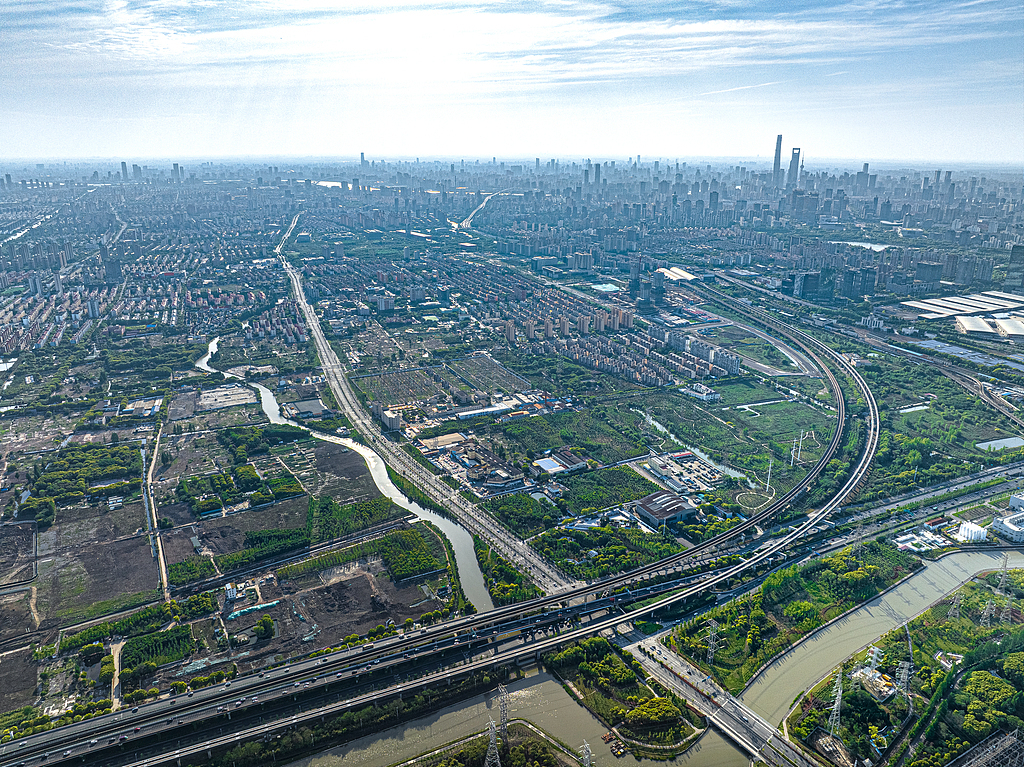
The panoramic view of the Beicai area through which the Bailianjing flows. Visual China Photo
Unlike the naturally formed Bai Lian Jing, Chuan Yang River is a masterpiece of modern water conservancy projects.
\West is Huangpu, East is Sea\ is a common saying about Pudong, Shanghai. In the 1970s, the industrial and agricultural production in the Pudong area of Shanghai developed rapidly, with water conservancy being the lifeline. However, the division of the Huangpu River and the Yangtze River estuary water systems split the Pudong water system into two incompatible areas of salt and fresh water, resulting in farmlands being flooded nine out of ten years and shipping being extremely difficult.
Starting from the cold winter of 1977, 300,000 people from Chuansha, using carrying poles and baskets as tools, spent two years to manually dig out an artificial canal - Chuan Yang River, which is 70 meters wide and 28.7 kilometers long. It is named after its starting and ending points, which are the coastal Chuansha Sanjia Port area and the riverside Yangsi area.
Its birth connects the Huangpu River with the East China Sea, linking Yangsi, Beicai, Zhangjiang, Tangzhen, Chuansha, Cailu and other places from west to east, converging the waters of more than 10 major north-south rivers along the way, leading to the East China Sea.
In the following four to five years, Chuan Yang River and Da Zhi River further overcame technical challenges and implemented the deepening and dredging of the Jia Tang area in steps, breaking through the barrier of the Huangpu River and the Yangtze River, which were separated by the Qin Gong Tang built during the Qing Yongzheng period, achieving the remarkable feat of integrating the two major water systems of the Huangpu River and the Yangtze River.
The area of farmland benefiting from the Chuan Yang River reaches 350,000 mu, achieving the remarkable effect of \irrigation guaranteed for a hundred days without rain, and all farmland is unaffected by waterlogging even with daily rainfall of 180 millimeters\. The water supply for various industries including agriculture, industry, and commerce is stably secured. The low-lying areas that used to suffer from waterlogging \nine times out of ten years\ and the factory and dock areas along the Huangpu River are now free from the threat of water disasters.
In the 1990s, the horn of Pudong's development and opening-up was sounded, and many major project materials were transported through the Chuan Yang River, including the Lupu Bridge, Nanpu Bridge, and later the World Expo park construction, etc.
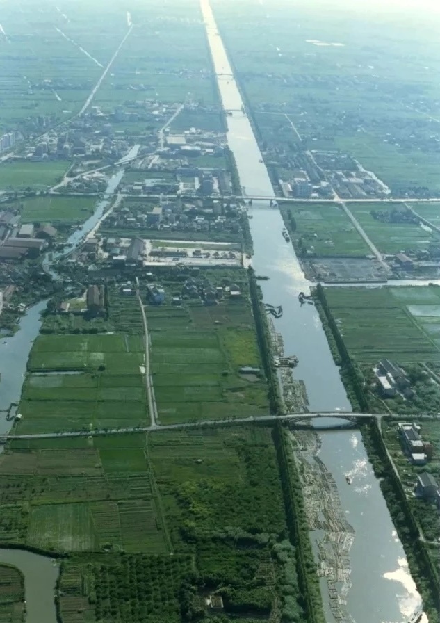
At the junction of the towns in Cailu, the Chuan Yang River. Image source: Pudong Archives
The Chuan Yang River in 1999. Image source: Pudong Archives
The Chuan Yang River writes the pioneering legend of Pudong's man-made canals, while the Longhua Port beside the Xuhui Binjiang tells the story of the waterfront rise of the industrial artery.
The history of Longhua Port dates back to the Yuan Dynasty. According to the records in \Longhua Town Chronicles,\ based on the Yuan Dynasty's \Jiahe Records,\ Longhua Port was \nine zhang wide and one zhang and eight chi deep.\ At that time, for the convenience of irrigation, a dam was built on the river. By the Ming Wanli years, it was changed to a sluice gate, and later it was rebuilt into a sluice bridge, which has been destroyed today.
The confluence of Longhua Port and the Huangpu River was historically home to a small sandbar known as \A Pearl,\ which no longer existed by the time of the Qing Qianlong era. Due to its eastern connection to the Huangpu River and its western link to Caohejing and Puhuitan, it has always been a crucial waterway. It was once the lifeblood of the prosperity of Longhua Town and a key channel for early foreign trade. Longhua Port was also a strategic pass protecting Shanghai City and the southwestern villages. In the early Qing period, the port was fortified with batteries, possessing dual importance for both military and transportation purposes.
Longhua Port has many bays, and there is an old saying, \Longhua has eighteen bays, each bay faces Longhua.\ In the old days, the river passed through the town. The water of Longhua Port comes from the Huangpu River, and turns west at the Chaihebang Bridge. It splits into two branches a hundred meters east of Longhua Temple, one goes northwest into Pu Huitang; the other turns south through the old street, and then to the Tongdao Bridge. This section of the river is relatively narrow and has many bays. When the tide rises, the water from the Huangpu River comes from the east, and the water flow is rapid, which seriously affects the navigation of ships and the drainage of water downstream.
Starting from April 6, 1964, the meandering section of this river was straightened, and a new straight waterway, 460 meters long and 30 meters wide, was created from Chaihebang to Tongdao Bridge, after which the central river of Longhua Town was abandoned. At the same time, the Shanghai Inland Waterway Administration dredged Longhua Port, increasing the ship navigation capacity from the original 60-ton class to 100-ton class. In April 1992, a pump gate was built on Longhua Port between Tongdao Bridge and Caohe Temple Bridge.
Starting from Laobaidu Street in the east, along Zhongshan South Road to the west to Longhua Port, the location of Xuhui Binjiang was once the Hu Nan industrial belt, an important part of Shanghai's industry. Longhua Airport, Shanghai Cement Factory, Jiangnan Shipyard and other national industrial giants gathered here, witnessing the rise of Shanghai's industry.
Before the World Expo, the Xuhui Riverside area was poised for takeoff. FromRecords of Shanghai, image source: West Bank Group
Expo Central: Catalyst for Urban Renewal along the Banks of the Shanghai Pujiang River
In 2002, Shanghai successfully bid for the World Expo, marking the beginning of the \deindustrialization\ of the two banks of the Huangpu River. To accommodate the construction of the Expo park, the different tributaries along the banks of the Huangpu River also saw their destinies rewritten.
The logistics splendor of Bailinjing Wharf has become history. In 2006, the relocation of Bailinjing residential area began. Over 20,000 relocated residents moved into the \Sanlin World Expo Home\, bidding farewell to this land filled with timber and sandstone. On October 8, 2007, the Bailinjing Port was permanently closed. The Bailinjing Wharf was also no longer in use and was transformed into the World Expo M2 Wharf, taking on the important task of water transportation in the World Expo Park.
As the only natural waterway in the Expo Park connected to the Huangpu River, the water quality and landscape of Bailianjing directly affect the overall image of Shanghai's Expo Park. Experts use ecological floating island technology to purify the waterway, while the water gate department stays on guard day and night to complete the scientific scheduling of tide-blocking and flood discharge.
In 2010, Bailinjing Park was completed, becoming a model of a public space that connects history with modernity. The sculpture group \Children of the World\ by French artist Riche Camo was introduced to the riverside walkway: 21 hollow dolls are inlaid with Beijing manhole covers, Shanghai cobblestone roads, and Paris metro signs, achieving a subtle balance between globalization and local identity. The crane that once lifted tens of thousands of tons of timber was deliberately preserved in a corner of the park.
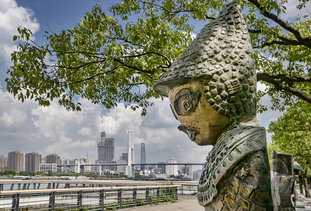
Shanghai Pudong Bailianjing Park. Visual China Photo
And more than 6 kilometers away from Bailianjing Park, on the Chuan Yang River, a large bridge has been constructed.
In 2009, the Chuan Yang River Bridge (Yao Long Road Bridge), an important supporting project for the World Expo, was officially completed. This bridge, with a main span of 165 meters, adopts a truss cable-stayed combination system, becoming a VIP channel connecting Pudong and Puxi, ensuring the efficient transportation of high-end passenger flow during the Expo period. The triangular truss of the bridge naturally diverts the lanes from the sidewalks and non-motorized vehicle lanes, meeting the traffic function while also becoming an organic part of the riverside landscape.
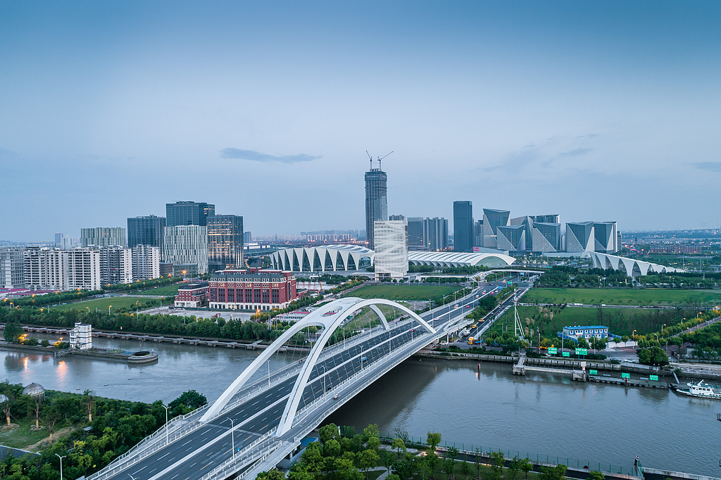
Shanghai Yaolong Road and Bridge. Visual China Photo
The hosting of the World Expo has accelerated the transformation of Chuan Yang River from a single shipping function to an ecological landscape. In 2011, the environmental protection and water affairs department of Pudong New Area commissioned the planning department to complete the \Preliminary Planning Study for the Construction of Chuan Yang River Ecological Green Corridor\, conducting a comprehensive and systematic study on the ecological green corridor along the entire Chuan Yang River, and drawing a beautiful blueprint for development.
Similar to Bai Lian Jing, the arrival of the World Expo also marked the beginning of \deindustrialization\ for the Longhua Port on the other side.
In 2008, Xuhui District initiated the urban renewal along the waterfront, with 116 enterprises relocating and 280 hectares of land being freed up. On both banks of Longhua Port, industrial relics have been revitalized through the empowerment of art.
The industrial landmark of the 1980s, the Maritime Watchtower, has been transformed into a \white magnolia\ shape, becoming the highest point on the Xuhui Binjiang waterfront; the old factories along the coast have been transformed into the West Bund Art Museum cluster and cultural venues, the Longhua Airport oil tank group has been transformed into the Tank Art Center, and the former site of the Nanpu Railway Station has become the Star Art Museum... They face the World Expo site across the wide Huangpu River.
The most iconic Longhua Port Bridge, with its \dragon's spine\ steel structure spanning the river, connects the urban business district on the north and south banks of Longhua Port with the riverside public open space. The Longhua Port Bridge features a double-deck design, with motor vehicles speeding on the upper level, while the lower level is dedicated to non-motorized traffic and pedestrian paths, allowing cyclists and strollers to resonate with the undulations of the river.
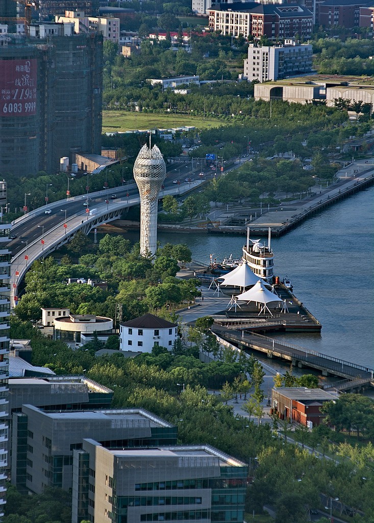
Shanghai Xuhui Binjiang Maritime Tower overlooks. Visual China Photo
Post-Expo: Regeneration of Riverside Culture and Reintegration of Urban Functions
Entering the post-Expo era, the radiating effects of the Expo continue to persist.
After the World Expo, the Bailianjing area continues to show new vitality. Bailianjing Park has become a new landmark for citizens to relax, with a 24-kilometer Pudong Binjiang cycling path passing through the park, high-line cycling paths, middle-line jogging paths under the forest, and low-line walking spaces forming a three-dimensional slow-moving system. Two 24-hour open fishing spots have met the needs of citizens to get close to nature.
In 2023, the more ambitious \World Expo Water Loop\ plan was launched. This 22-kilometer water loop will connect important areas such as the Bailianjing region, the World Expo area, the Qiantan area, and the Xinyangsi area, creating an urban green vein that integrates sightseeing, sports, and culture. The industrial lifeblood of the past is transforming into a new network for urban quality of life.
If we say the post-Expo keyword for Bailianjing is \diverse ecology,\ then the Chuan Yang River, which began with a struggle between humans and nature, has moved towards the \waterfront living room\ of Zhangjiang Science City, a positioning of technological intelligence.
In 2021, the construction of the Chuan Yang River Ecological Green Corridor accelerated, becoming the ecological main artery of the northern part of Pudong. Innovative landmarks such as Zhangjiang Artificial Intelligence Island and Medicine Valley have sprung up along the banks of the Chuan Yang River. The Chuan Yang River meanders through the Science City, connecting several major areas of Zhangjiang, becoming an important landscape and carrier in the central core area of Zhangjiang Science City, providing public places for leisure, sports, and entertainment for Zhangjiang's 500,000 employees.
By the Chuan Yang River, the latest scientific and innovative cultural landmark in Zhangjiang, the Zhangjiang Science Hall, quietly watches the river flow. Unmanned boats from the Artificial Intelligence Island patrol the river surface, while residents around leisurely take walks under the greenery. The slow traffic system connects research institutions, commercial districts, and riverside green spaces, achieving a deep integration of \technology + ecology + life\.
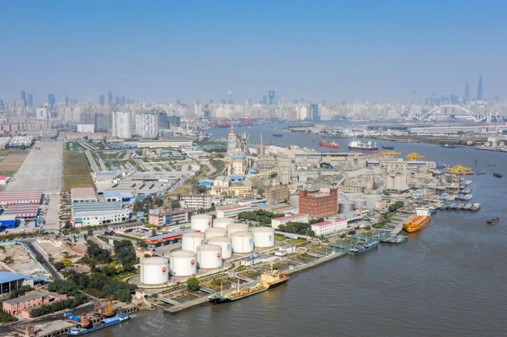
Aerial view of the Pudong World Expo Houzhan Chuan Yang River. Visual China Photo
The Chuan Yang River, which began with a carrying pole and a dustpan, perhaps never imagined that the river of time would lead it to a narrative of technology and innovation. Similarly, the \production fortress\ Longhua Port, which was once busy with the construction of national industry, has turned towards becoming a global landmark of art and humanities.
The banks of Longhua Port are rising as an international cultural gathering area. Cultural landmarks such as the West Bund Art Museum and Long Museum stand along the river, and events like the West Bund Art & Design Fair and the Shanghai Biennale held annually attract art enthusiasts from around the world.
In May 2025, the Longhua Wharf, which transformed from the century-old industrial site of Shanghai Cement Factory Wharf, was officially put into use. Cruise ships sounded their whistles and set sail, shifting from shipping functions to urban leisure tourism, and further adding a water-friendly spot to the popular and vibrant waterfront area along the Xuhui Riverbank.
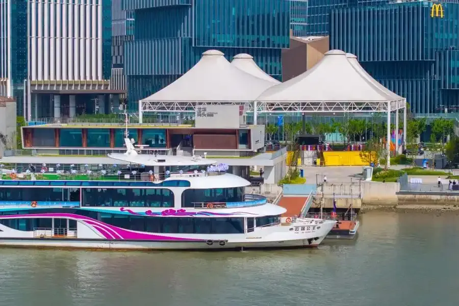
Shanghai Longhua Wharf, the new Yangtze River cruise ship \Princess Yunjin\ sets sail for the first time. Wenhui Daily Photo
According to data from the Shanghai Municipal Housing and Urban-Rural Development Commission, in 2024, the \One River, One Creek\ waterfront spaces attracted more than 300 million visitors, an increase of about 10% compared to 2023. Among them, Xuhui Riverside attracted 30 million citizens and tourists throughout the year, accounting for about 1/10, which can be said to be one of the most vibrant public spaces in Shanghai.
From the Bailianjing canal dug by the salt farmers of the Song and Yuan dynasties, to the Chuanyang River dug by the shoulders and hands of 300,000 people from Chuansha, and then to the Longhua Port where merchant ships shuttled through the Yuan and Ming dynasties, the water systems of Shanghai have always been silent witnesses to the evolution of the city.
Shanghai's water systems have long transcended the mere significance of geographical coordinates. They bear witness with flowing resilience to how urban vitality can be sustained and stirred in the symphony of water and land in the process of Chinese modernization.
The legacy of the Shanghai World Expo lies not in the 184-day grand event, but in its impact and inspiration: true renewal is never about starting from scratch, but about allowing every piece of history to become the roots that nourish the future.
The river of time surges ceaselessly, the cranes of Bailianjing freeze the industrial memory, the unmanned boats of Chuanyang River cruise in the wave of technological innovation, and the oil tank art center of Longhua Port reflects the light and shadow of the era. These rivers, which once bore the rise and fall of the city, still carry the lingering warmth of the World Expo and the expectations for the future, continuing to write the symbiosis of people and water that belongs to the city of Shanghai.
Because where the water flows, the old chapters will eventually become new ones.
——————
The special article of \Tide Marks\ is co-created by the Shanghai Local Chronicles Office and the Pengpai Research Institute, focusing on the changes and rejuvenation on the Huangpu River.
\A Huangpu River, half of Shanghai's history,\ by tracing the renewal and regeneration of the tributaries, mouths, and ferries on the Huangpu River, we attempt to find a small footnote in the ecological and humanistic development plan of a metropolis.
Tranalysis